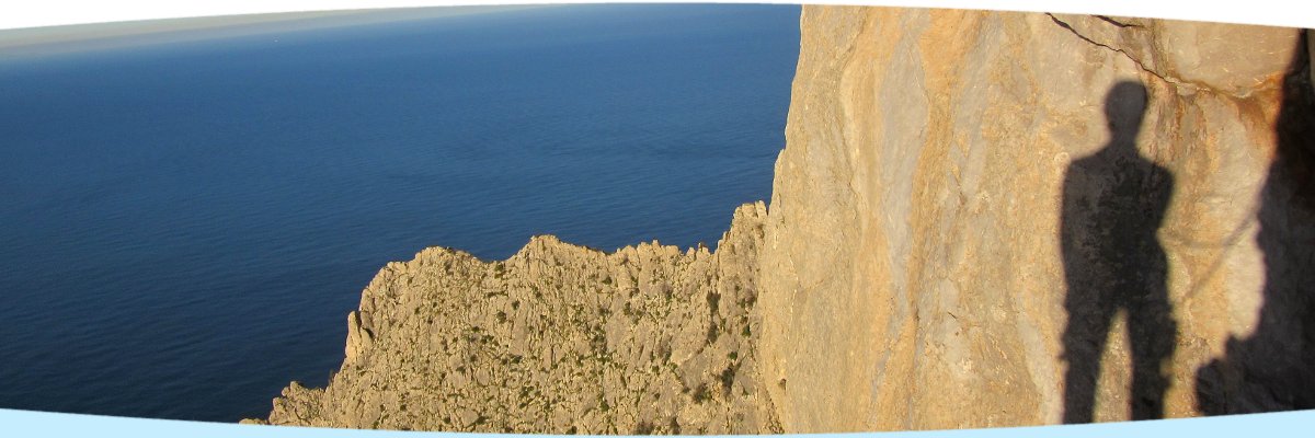
In the northwest of the large island of Sicily rises Monte Gallo, a mountain with several peaks. The highest peak is the Monte Santa Margherita with an impressive, west-facing rock wall. This rock wall is directly straightened to the open sea and crossed by great dihedrals, cracks and rough slabs.

The wall with the routes.
Already 35 years ago, the first climbing tours were opened here. Many of them were opened by Roby Manfré Scuderi. His classics and other tours are listed on www.sassbaloss.com.
For the new climbing routes were predominantly selected the edges and steeper passages. In this way you can clever avoid the distinctive growth of plants in the wall.
The new routes:
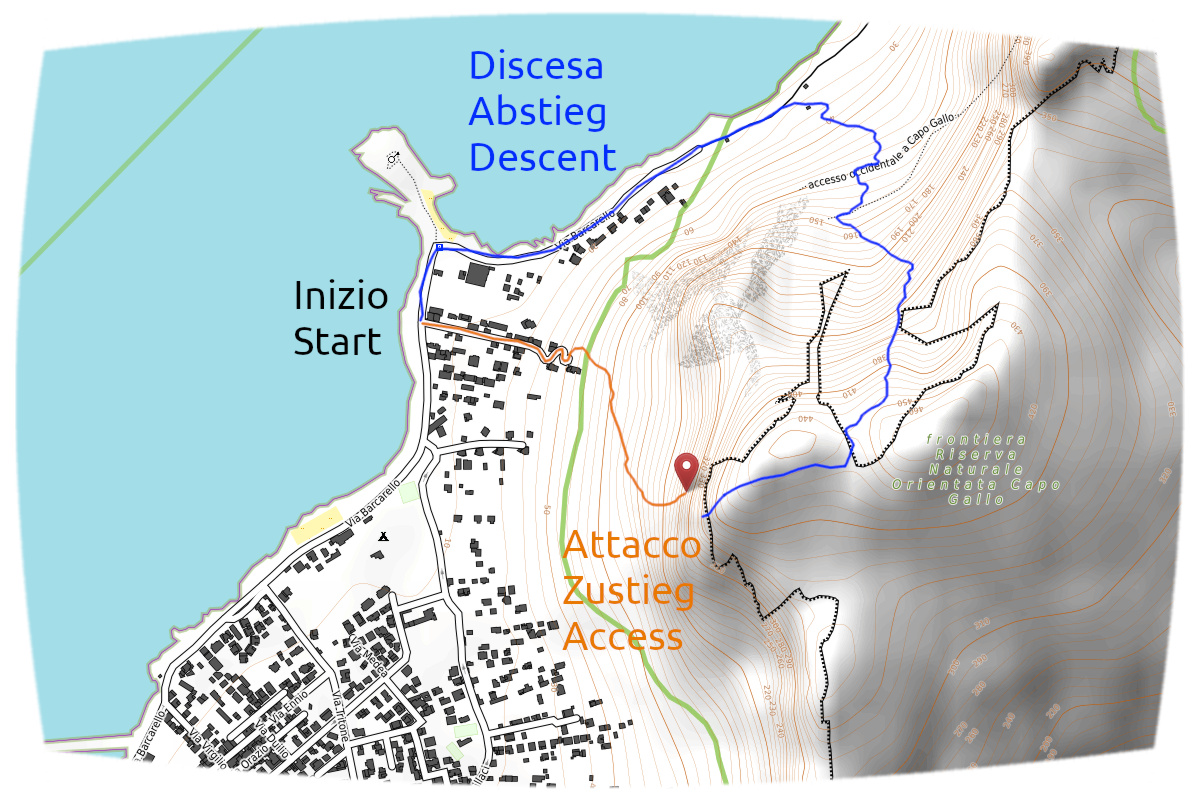
Access to the wall:
Drive on the road “Via Barcarello” on the outskirts of Sferracavallo along the coast. Park on the roadside about 150m before the little headland (is also the end of the road with a turning area) close to the bus stop “Punta Barcarello” (from 30 September free of charge).
Walk from the house number 61 on the (only) little road away from the coast in direction wall. At the last house the road changes to a indistinct track. Go uphill to the right, follow the stone men and pass below a fence. Go on a trail more uphill until a branch-off where you can cross to the left to Quota 280 or to the right to Santa Margherita.
To Margherita you cross to the right and pass directly the rocky promontory oft the west ridge. Then cross more to the right only little increasing until the trail with stone men leads directly up to the foot of wall. Go left or right along the foot of wall to reach the tours.
Duration: approximately 30 minutes
Descent:
Better descent
January 2022 a better descent was discovered, keeping left after the wind valley instead of right:
From the wind valley, keep left downhill until you reach the first trees. Then continue, always keeping slightly left, first along a rock wall and then through a forest and rocky terrain. Finally, again along a wall and over open terrain down to the hiking trail. (all marked with stone men)
An updated sketch and detailed description follows.
Previous descent:
Cross the grassy slope to the left (north) into a wind valley (big stone man). Walk downhill on indistinct tracks and go through bush and crushed rock zones in direction to the right rocky promontory (direction north). The trail becomes under the rock wall more and more clearly and is marked with stone men.
When the tree and bush zone ends, you go downhill to the left over a stony lawn. Pass the bigger rock and go on the crossing hiking trail short to the right. Walk again on a path downhill over the stony lawn and on the second hiking path also to the right. At the stone man follow the well recognizable path downhill and through a pine forest to the gravel walk. Along the coast you get back to the starting point.
Duration: approximately 60 minutes
Map previous descent:
orange: access, start from the via Barcarello
blue: descent